Recently, I produced a video showing a map of the cemeteries within my home state of Tennessee. The purpose of that cemetery density map is to give you an idea just how many cemeteries are out there, and to show you the possibilities you have when starting your own Grave Care Business.
Cemetery Maps Are Important
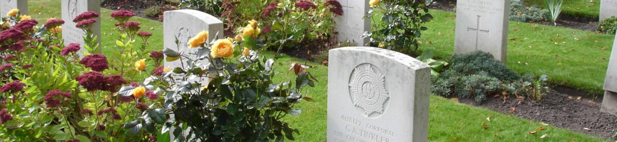
Maps of cemeteries are incredibly useful as they serve several purposes. The maps included in this article show geographic location and density data of individual cemeteries. Cemetery maps can also display locations of individual gravesites within a cemetery. This helps visitors find the gravesites of their loved-ones.
I am currently back at school learning how to make technical maps. Maps are tools that can be used to display so much more than simple location data. Maps of cemeteries are valuable tools that facilitate navigation, spatial understanding, decision making, analysis, emergency response, historical documentation, and education.
Macomb, Michigan
One of my subscribers asked for a map showing the cemeteries within their home county of Macomb, Michigan.
A little bit of research on Macomb, Michigan shows this county is located in Eastern Michigan. If you think of Michigan as being shaped like a mitten, Macomb is located at the eastern base of the thumb, below the lower knuckle, on Lake St. Claire.
Macomb County has a population of almost 900,000 people and it is considered part of the Detroit Metro area though Detroit proper is not within the county.
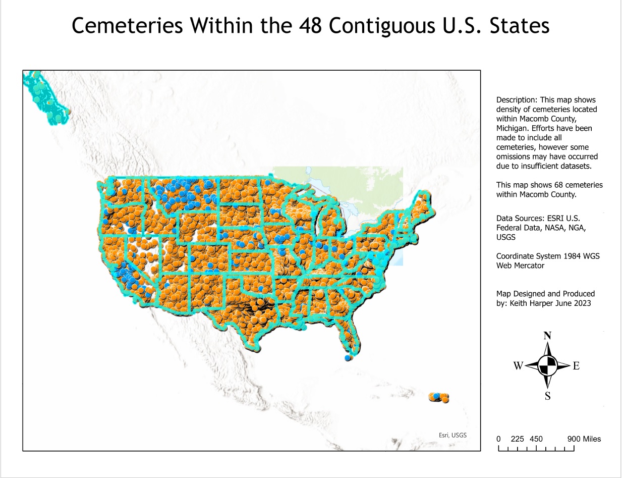
The maps below were produced with ArcGIS Pro using an original dataset of 171,000 cemeteries across the entire United States. ArcGIS is professional mapping software. No dataset is completely comprehensive and some cemeteries might not be included in this map. However, with 171,000 cemeteries listed, my confidence is high that most established cemeteries are included.
Cemetery Maps
The first map shows location data for cemeteries across all 48 states. Alaska is partial shown as is Puerto Rico. At this scale, much of the data is difficult to decipher. However, this does give you a good indication of just how many cemeteries are in existence.
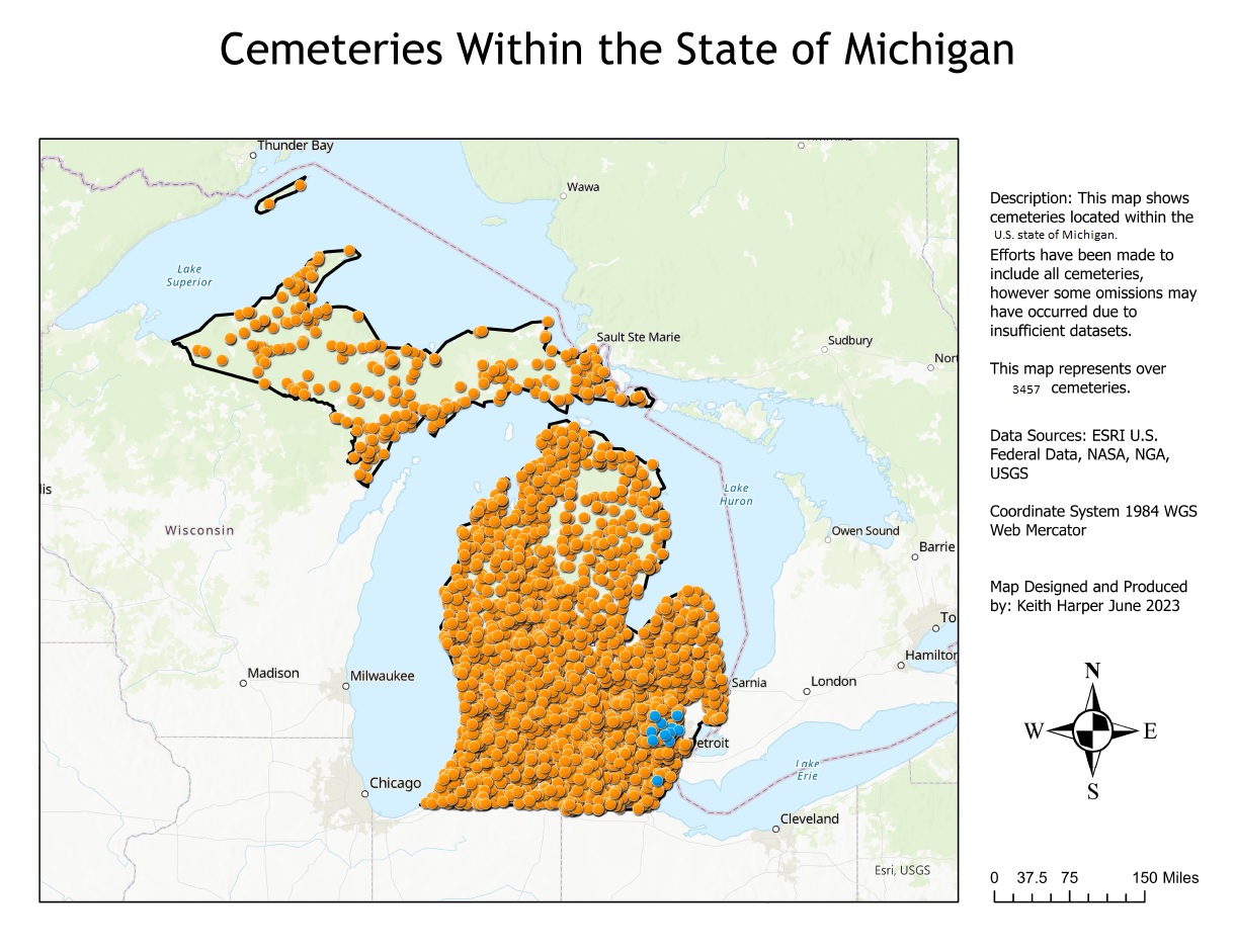
Within the state of Michigan, there are 3457 cemeteries.
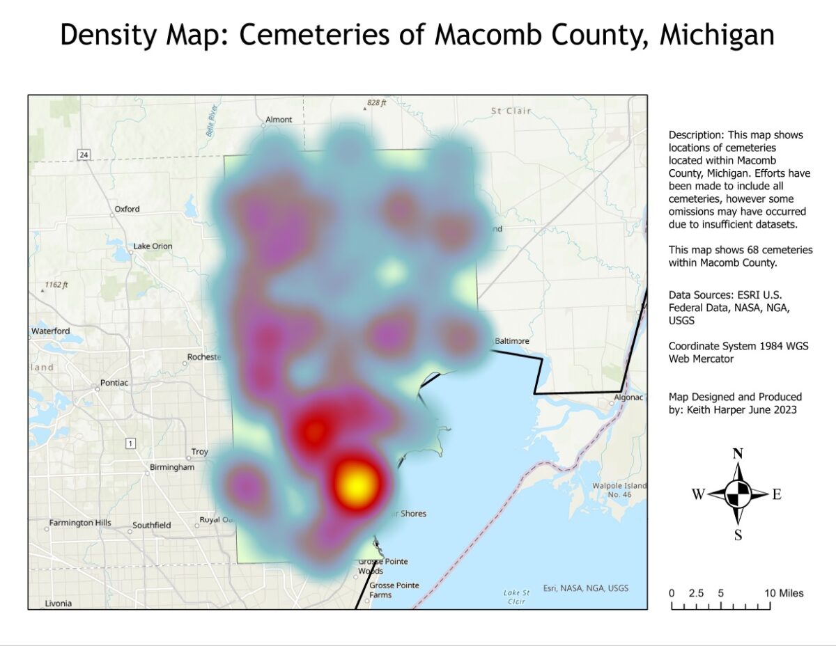
Once all the cemeteries in Michigan were found, Macomb County was isolated. 68 cemeteries were found within Macomb County’s borders. (Note: Though I did my best to include all the cemeteries within Macomb, a few might have been missed due to improper historical record keeping.)
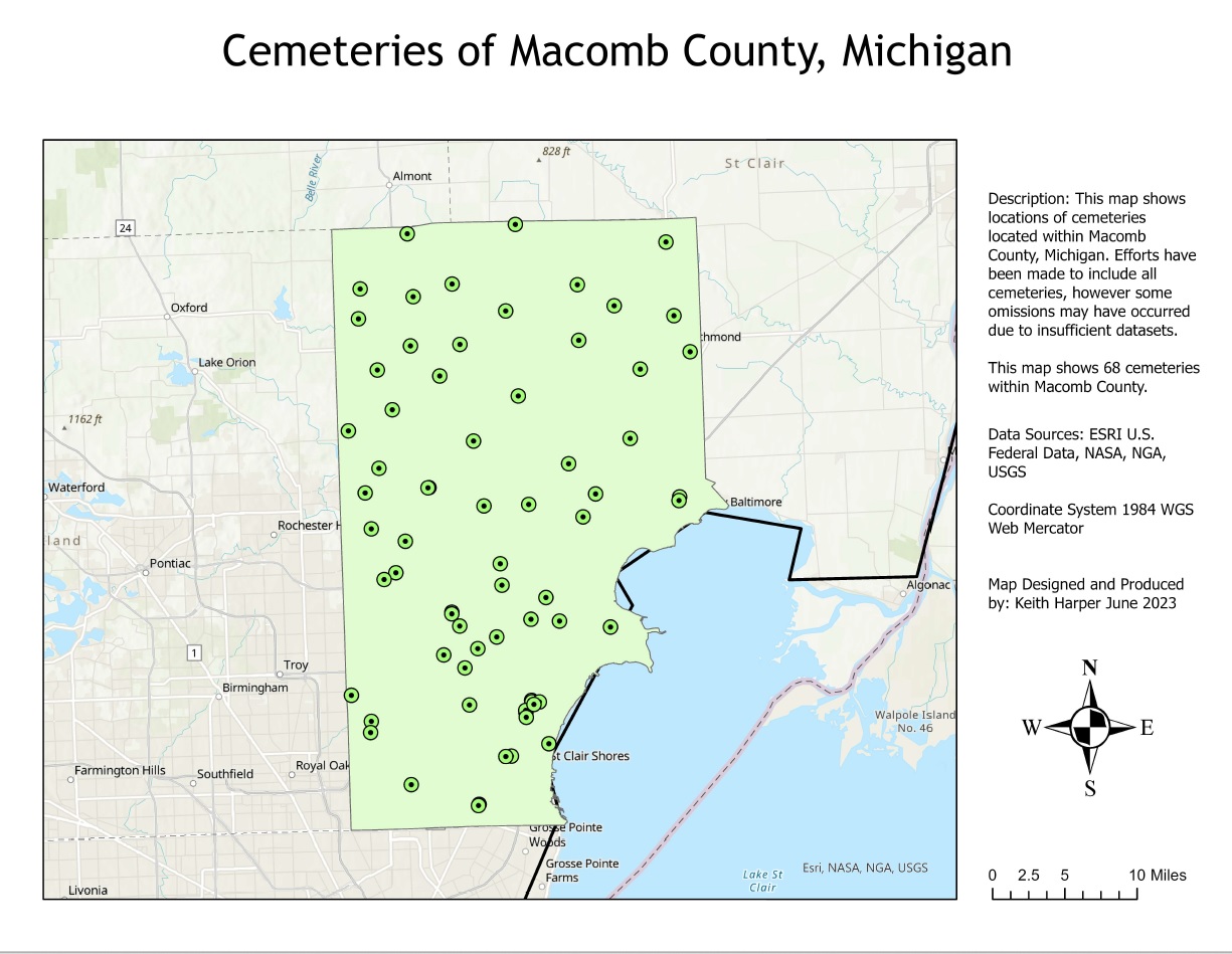
Generally, I consider that someone starting their own Grave Care Business needs about 3 or 4 cemeteries to begin building a strong client list. With there being 68 cemeteries in Macomb County and 3457 within Michigan, there are LOADS of opportunities for anyone wanting to start their own Grave Care Business. Realistically, competition is not going to be much of a factor even if other companies are offering these services.
Cemetery Distribution: Macomb Michigan
Heat Maps are useful in determining the distribution of cemeteries across a wide area. This heat map shows the location of greatest density of cemeteries within the county. As you probably would suspect, there are a lot of cemeteries located in the southern portion of the county near where the highest population of residents live due to Detroit being nearby. Other than the cemeteries defined by the concentration of population controlled by the greater Detroit area, cemeteries are quite evenly distributed across the entire county.

Do you love cemeteries and have you ever thought about starting your own Grave Care Business? I am passionate about the proper upkeep of Cemeteries and I am also passionate about Entrepreneurs who want to start their own business.
Grave Care and Cemetery Density
If you have ever thought about starting a Grave Care Business, please look through our website. We have developed a professionally produced Grave Care Business Course designed to help you Start Your Own Grave Care Business.
I want to say “thank you” to my subscriber in Macomb County Michigan who asked me to make a map of the cemeteries in their home county.
If you would like a map of the cemeteries where you live, please subscribe and leave a comment with your home state and county and I will make a map for you, too.
Start a Grave Care Business
Once again, my name is Keith. If you want to learn more about the Grave Care Business course, the website address is: www.GraveCareBusiness.com
About Me (Keith): I am passionate about cemeteries and the proper upkeep of our nation’s burial grounds. For more than 20 years, I have fought for our cemeteries to be well-maintained hallowed grounds. There are too many neglected cemeteries that fall into disrepair. Neglected cemeteries are at risk of being vandalized. I am also passionate about entrepreneurs who want to make a difference in their own lives by starting their own businesses.
In August, I returned to school to learn the science of Cartography (Map Making). My goal is to advance my understanding of cemeteries by becoming a professional cartographer making beautiful maps of cemeteries.
